
Copyright: Blair Costelloe
Bird’s-eye view on gelada monkeys
Could drones help observe gelada monkeys? Blair Costelloe and her colleagues, Ben Koger and Jeffrey Kerby, see great potential in this. Their goals are to assess the feasibility of using drones to observe gelada monkeys, establish protocols for collecting drone-based data in the context of an ongoing, long-term study of the gelada population, establish the necessary infrastructure at the field site to support drone-based data collection and collect preliminary proof-of-concept data to support external grant applications.
“It’s always exciting to get a new perspective on a study species,” says wildlife biologist Costelloe. In this case, the new perspective is literal! “A bird’s eye view highlights patterns and phenomena that are simply not observable from the ground. I think once we start getting footage from the field, we will have a long list of exciting questions to tackle.”
-

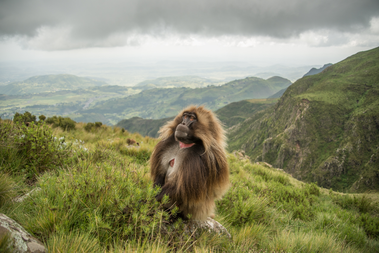
A gelada monkey Copyright: Jeffrey Taylor Kerby -

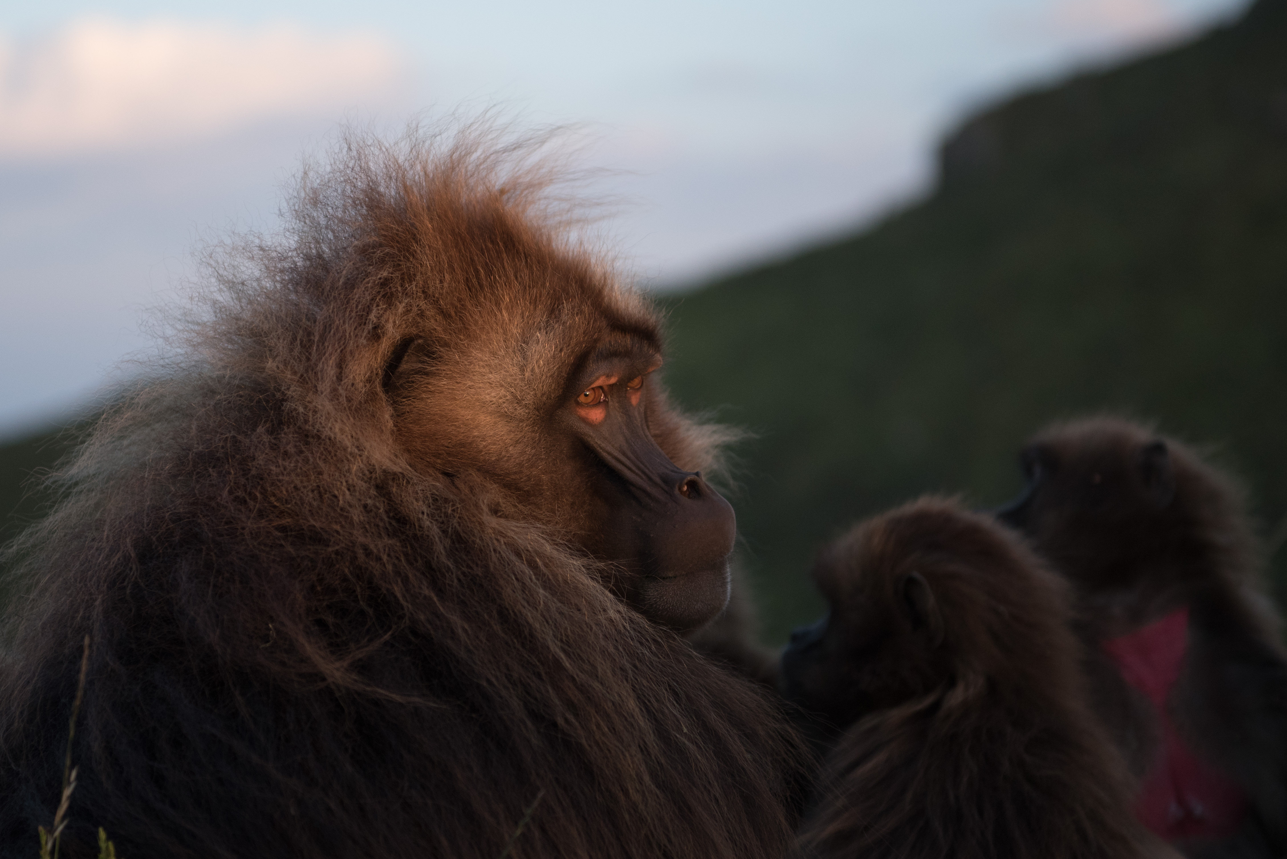
A gelada monkey Copyright: Jeffrey Taylor Kerby -
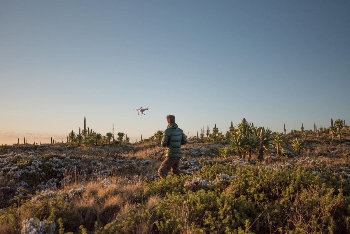
A drone being flown in the field Copyright: Jeffrey Taylor Kerby

This project is the start of a broader effort to combine state-of-the-art, drone-based behavioural observations with conventional collection of behavioural data in a long-term study of a wildlife population. “We think this combined approach will allow us to answer questions that would not be possible to address using either approach in isolation,” says ecologist and geographer Kerby. For example, drone-based observation allows for precise quantification of spatial relationships and movement trajectories for all filmed individuals, but the distance of the drone does not allow for identification of individuals.
This long-term study, the Guassa Gelada Research Project, has already generated 12 years of data on more than 500 known individuals, from which ~ 200 are still living. The researchers have habituated the monkeys to allow for behavioural observations from within the herd. COVID-19 and the political unrest in Ethiopia have put their fieldwork plans on hold. However, they hope it will resume in early 2022. But what exactly is the significance of using drones? “From a ground-level angle, it is impossible to gauge spatial relationships between individuals, and human observers can only watch one or two animals at a time,” explains electrical engineer Koger. “By combining both these data streams, we can answer questions about the role of individual decision-making in directing collective foraging and movement in ways that were not previously possible.”